Free · France
Vannes: Old port and timbered merchant streets
A merchant street cannot be understood entirely from its façades. At Vannes, the useful question is what happened behind them: how a room facing the port connected with storage, domestic space and another street. The block between rue du Port and rue du Drézen preserves evidence of that depth. The regional heritage inventory identifies many plots running between the two streets, rather than ending a short distance behind their waterfront fronts. Inventaire général and Ville de Vannes, rue du Port, IA56003260, Description.
This is the feature examined here: the deep port-side property, with a public face and less conspicuous working spaces. Published legal records, architectural surveys and a museum painting reveal different parts of it. They also prevent the attractive but unreliable assumption that exposed timber tells us when an entire house was built, who occupied it or what passed through its doors.
Two streets and one working block
Rue du Drézen is not simply a picturesque parallel street. Its inventory dossier describes it as serving the commercial and storage activities of the merchant houses facing the port. On its eastern side, plots extend through towards rue du Port; to the west, former convent enclosures constrained their development. The two streets therefore belong in the same explanation of how this block worked. Inventaire général and Ville de Vannes, rue du Drézen, IA56003450, Historique and Description.
That relationship changes the scale of attention. A narrow frontage is an edge of a property, not a complete account of its capacity. Behind it might be more building, an open court or a different level reached from the other street. A cadastral parcel and a building are not interchangeable things: one plot can contain several structures, while later alterations can complicate their relationship.
The district inventory places the quay's formation between 1604 and 1612, along a street previously bordering the shore. It reads the sequence of gabled houses at numbers 28, 30 and 32 as evidence of an older pattern of narrow plots and rooms arranged in depth. This is a survey's interpretation of surviving fabric, not proof that every room retained its original use. Inventaire général and Ville de Vannes, Quartier du port, IA56003203, La ville et son port.
A doorway described by notaries
At 34 rue du Port, a published transcription supplies something more precise than a general association with trade. On 24 March 1767, notaries recorded the taking of possession by Joseph Macé, identified as a merchant, and Jeanne-Marie Aillo. They entered a ground-floor store room with a double-leaf door and two large windows towards the port. Another door connected it to a vestibule; a small cellar lay beneath the stair. Inventaire général and Ville de Vannes, IA56003491, annex Prise de possession 1767.
The source establishes occupation and spatial relationships through a legal act, rather than through architectural appearance. Its doorway is especially useful: it makes the waterfront room part of a connected interior, not an isolated shopfront. It does not tell us which cargo crossed that threshold, how often deliveries arrived or who carried them. A plausible loading scene would still be an invention.
The same dossier reports substantial internal alteration in 2001 and additional exterior windows. Its historical description must not be mistaken for an account of an intact, accessible interior today. The transcript was consulted here, not the original deed. IA56003491, Historique and annex.
A store room could be a separate property
The archive summaries for 28 rue du Port complicate the idea of a single merchant owning one complete house. They record transactions involving upper floors and attics in June 1784, followed in August by the sale of a store room occupying the whole ground floor to Antoine Léonard, known as Champagne, and Angélique Le Cudon. The cited archival reference is Archives départementales du Morbihan, 33 G 18. These are published abstracts, not deeds independently examined for this article. Inventaire général and Ville de Vannes, IA56003445, Documents d'archives.
Property history thus adds a distinction that an elevation cannot show. The physical shell, the occupied rooms and the legal interests in them need not coincide. Calling the whole building a merchant house can be convenient, but it risks concealing how rooms were divided, acquired or combined.
The dossier also records the advancement of the ground floor in 1870 under a street-alignment scheme, citing municipal file 1O216. The port-facing threshold itself was therefore changeable. Its position cannot simply be projected backwards from a modern photograph. IA56003445, Historique.
Rebuilding did not erase the depth
At number 10, the front was rebuilt in 1747 for Nicolas Viel and Suzanne Lucas; the inventory records its sale to merchant Mathurin Danet in 1758. A wall from the earlier timber-framed house remained. The later arrangement has front and rear buildings joined by a stair block around a central court, with a side passage shared with number 12. The rear building faces rue du Drézen and includes a partly buried cellar. Inventaire général and Ville de Vannes, IA56003264, Historique and Description.
Here, a limestone street façade does not mean that the property ceased to belong to the older spatial pattern. Nor should timber and stone be treated as two self-contained periods, one commercial and one residential. The record shows replacement and retention within a single property. Its plan is more informative about access than a simple division into “old wooden houses” and “later stone houses.”
The comparison is not an invitation to enter a passage or seek out a private court. These are documented arrangements, used to explain the block rather than to promise an itinerary through it.
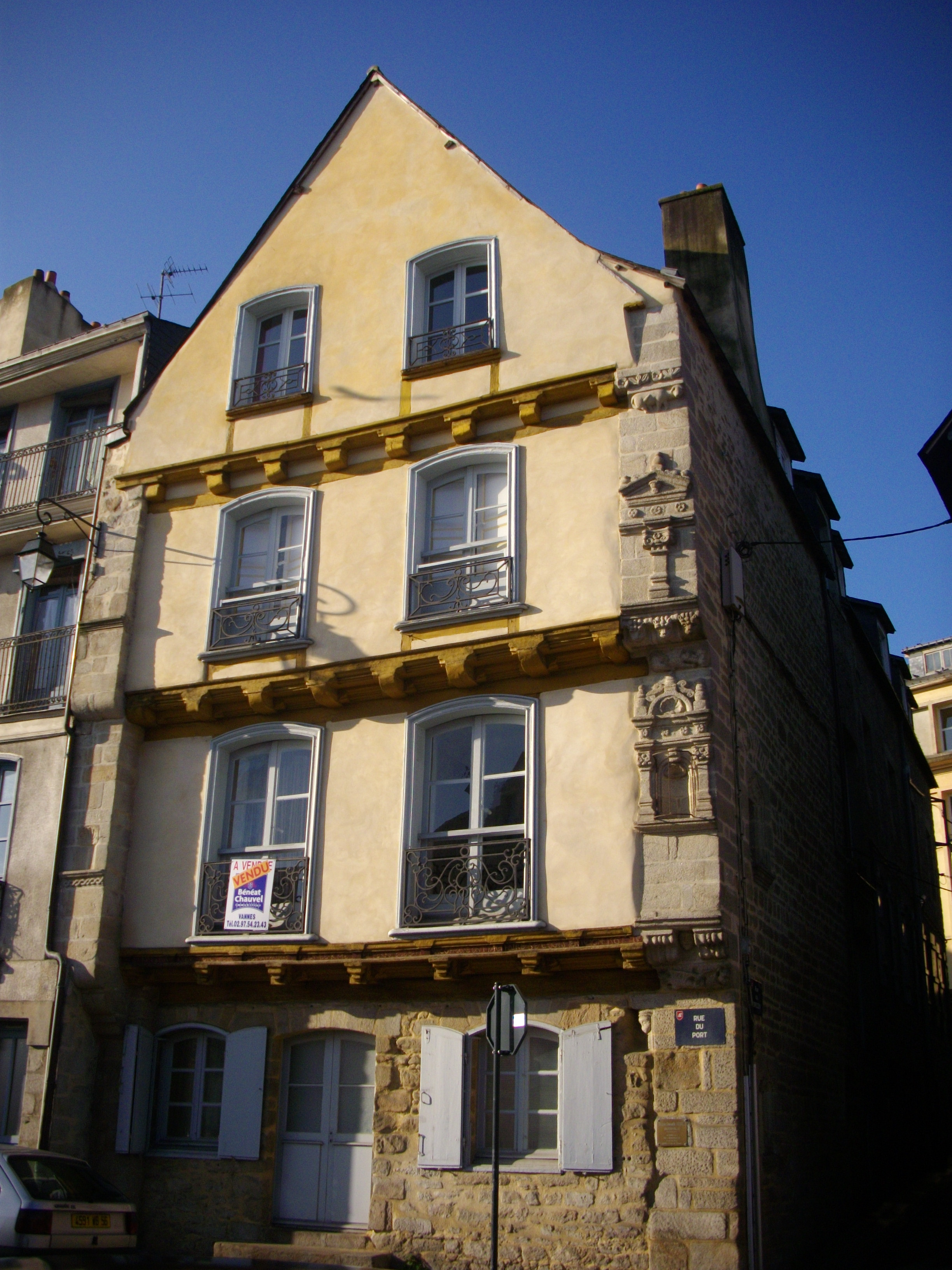
Maison Saint-Yves at 2 rue du Port in November 2011. Render, exposed structural ends and stone details coexist in this dated exterior view. The image cannot date every alteration or establish access to its private interior. Photo: Fab5669, Wikimedia Commons; CC BY-SA 3.0. Unmodified by publisher.

A dated timber does not date every alteration
The Maison Saint-Yves, at 2 rue du Port and 1 rue du Drézen, offers a useful control on dating. Its inscription names Yves Le Kermet and Perrine Le Bar and gives 1565. Yet the inventory also records eighteenth-century changes to the central part of the house, its staircase and port-facing windows, followed by alterations to openings on the Drézen side in the nineteenth century. Inventaire général and Ville de Vannes, IA56003261, Historique.
An inscription anchors a building campaign; it does not make everything surrounding it contemporary. Likewise, a named commissioner does not establish an occupation unless another source supplies it. The point is not to distrust the visible building, but to ask it appropriately limited questions. Its different sides may preserve different stages of adaptation.
The port seen from the water
The local museum preserves another kind of evidence. Its 2022 programme reproduces Jean Frélaut's Le port de Vannes avec la goélette blanche, dated 1925 and identified as oil on wood. In that reproduction, a broad pale sail interrupts the dark sky. The waterfront buildings form a compact band behind the vessel, with further roofs rising beyond. Musées de Vannes, April–September 2022 programme, p. 5.
The painting makes the connection between boats and city immediately visible. It cannot show the depth of the properties behind their fronts, establish a store room's ownership or reconstruct the eighteenth-century interior at number 34. This is a later artistic representation, not a substitute for a plan or deed.
The programme also builds a children's mystery around the painting, explicitly marking its wartime story as fictional. That distinction matters: museum interpretation can encourage imaginative engagement without supplying new historical testimony. No current display of the work is assumed here.
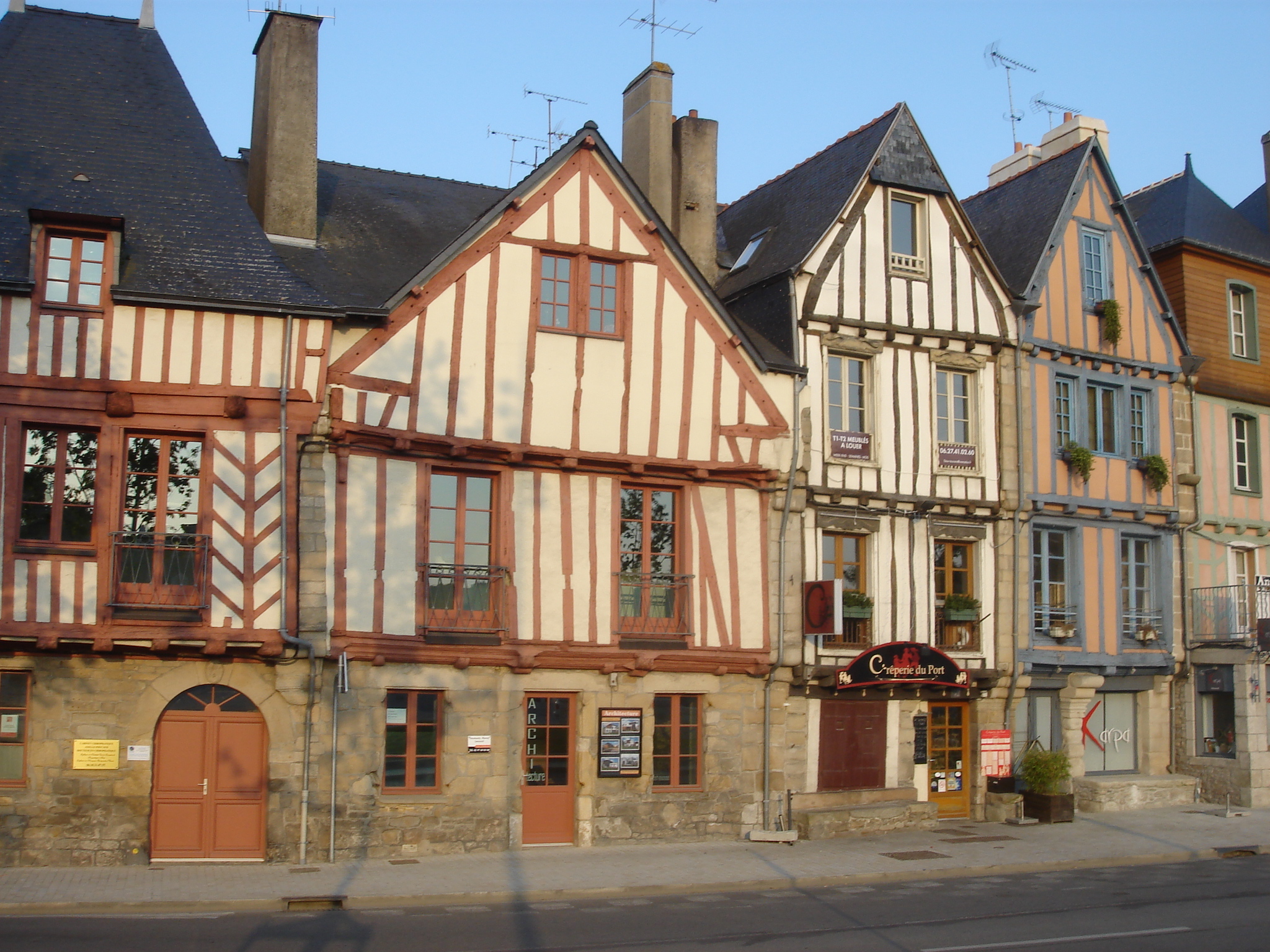
Rue du Port façades in April 2011. The narrow fronts help frame the question of property depth, but the street photograph does not reveal rear courts, ownership divisions, original paint colours or historical cargo. Photo: NdeFrayssinet, Wikimedia Commons; CC BY-SA 3.0. Unmodified by publisher.

Exposed timber has a history too
The city's conservation-plan report supplies an important corrective to the familiar timbered streetscape. On page 192, it places a postcard of rue du Port and the Rabine from around 1900 beside a 2013 photograph of exposed framing. Its accompanying discussion explains that historic photographs show timber façades covered with render, with projecting structural elements still visible. It connects rendering with protection against fire and the imitation of stone. Ville de Vannes and DRAC Bretagne, PSMV presentation report, approved 2018, printed p. 192, PDF p. 196.
The comparison does not date the stripping or repainting of each façade. It does show why visible framing should not be treated as an unchanged surface handed down from the sixteenth century. Restoration choices can make one part of a building's construction easier to read while making another period of its appearance less evident. A cleaned, colourful frontage may be historically informative without reproducing the appearance familiar to every former occupant.
Conservation concerns homes as well as views
Vannes's municipal magazine described façade work in 2022 alongside a programme intended to improve housing and reduce vacancy. It reported a compulsory façade campaign in the Saint-Vincent, Poissonnerie and Poids-Public sector, with another campaign beginning elsewhere. This is evidence of the municipality's stated priorities at that date, not proof of the treatment received by any particular rue du Port house. Ville de Vannes, Vannes Mag 135, September–October 2022, pp. 16–17.
That housing perspective belongs beside the archival one. The spaces behind the façades were not merely the supporting scenery for a harbour, and preserving them cannot be reduced to preserving a photographable frontage.
These documents were made for particular purposes, not to record an ordinary working day. Knowing where a store room stood does not identify everyone who used it. Labour, tenancy and household routines remain questions for further evidence, rather than gaps to fill with a generic scene of maritime bustle.
The sources do not deliver one seamless view. Legal descriptions identify rooms and rights. Building surveys trace arrangements and changes. The museum painting offers a composed relationship between water and city; civic conservation records address what later generations retain or reveal. Read together, they make the old port's timbered streets more specific: properties with depth, divided uses and altered thresholds, rather than a row of supposedly timeless merchant façades.
Locate the town
For regional orientation, open a Google Maps search for Vannes. This community-level search is not an exact building entrance, a verified walking route or permission to enter a workshop, museum or private property. Check the institution’s own current access information separately.