Free · France
Vannes: How the Gulf of Morbihan shapes local transport
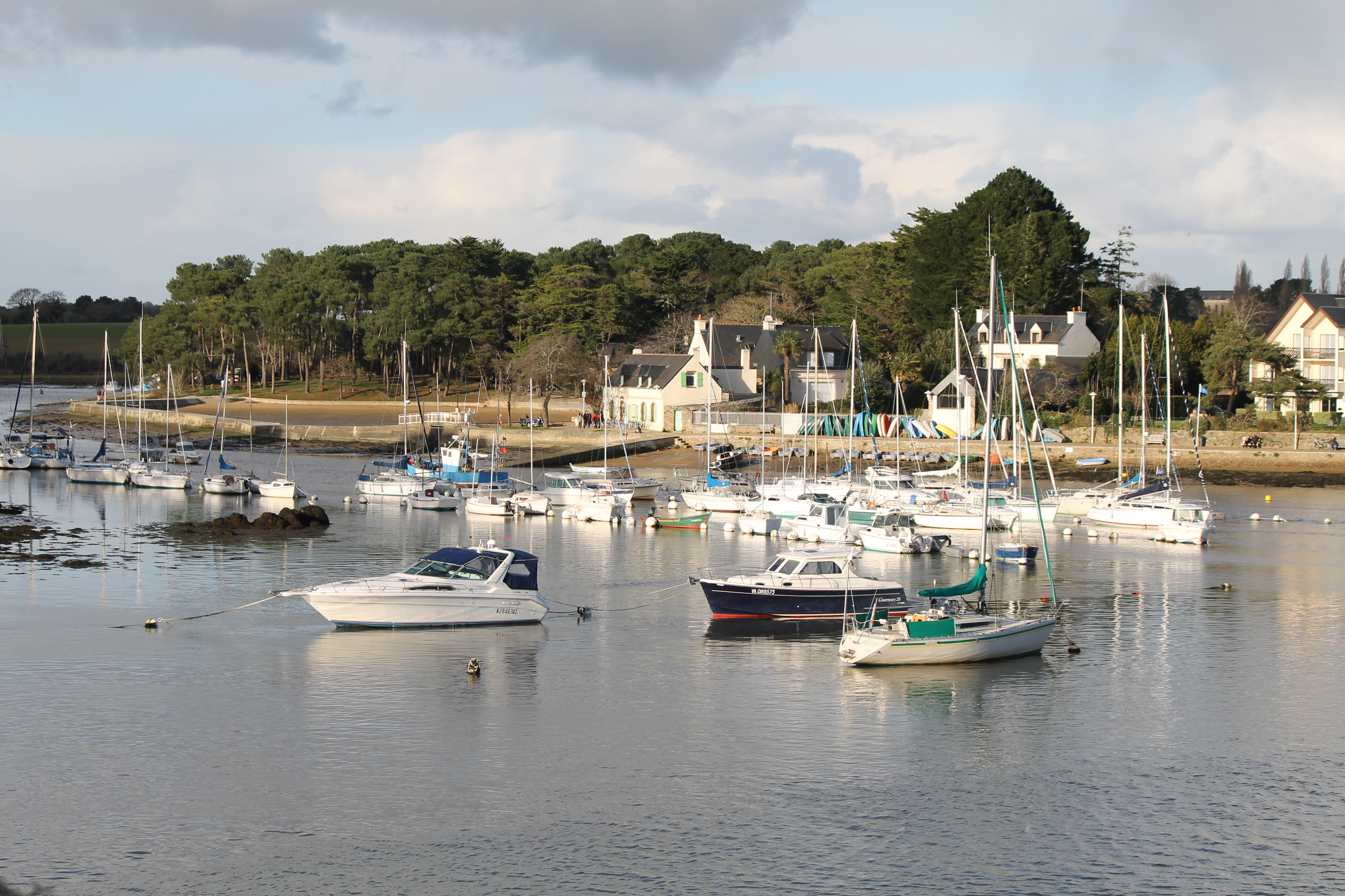
The Gulf of Morbihan does not simply put water between Vannes and its neighbours. Its inlets create places where crossing a short stretch of water can connect shores separated by a longer land journey. At Conleau, the useful example is the passage to Barrarac’h in Séné. The question is not which boat a visitor should catch, but how this small connection acquired landing places, served different users and was later re-established as a seasonal service.
The regional maritime inventory describes a deeply indented, estuarine landscape in which slips and landing places connected coastal communities. Its account of Conleau identifies several historical passages, including one towards Langle and Séné. These must not be flattened into a single timeless ferry route. A landing place could serve different destinations, while an enduring place-name could conceal changes in the actual point of embarkation. Inventaire général and Parc naturel régional du Golfe du Morbihan, IA56132141, Presentation and Le goulet de Conleau.
Conleau viewed from Port-Anna in Séné in December 2011. The view makes the relationship between opposing shores tangible. The leisure craft shown are not identified as the Petit Passeur, and the photograph predates the modern service revival. Photo: Stéphane Batigne, Wikimedia Commons; CC BY-SA 3.0. Unmodified by publisher.

A crossing before an adequate landing place
An engineering report gives the connection a more definite form. According to the official inventory’s summary of an 1885 Ponts et Chaussées report, residents had constructed a poor dry-stone slip at the point of Barrarac’h. Two registered seamen maintained it and carried pedestrians from the Séné peninsula towards Conleau and Vannes. The record describes an existing service whose shore infrastructure was inadequate, not the invention of a route by engineers. Inventaire général and Laboratoire GÉOMER, Cale de passage de Barrarac’h, IA56006404, Historique.
The same dossier records a comprehensive rebuilding in 1895, costing 3,900 francs: 2,600 from the state, 1,000 from the department and 300 from the commune. It cites the departmental archives’ S 790 files. These figures make the slip a shared public investment rather than merely a convenient patch of shore. They do not establish passenger numbers, fares or the earnings of the two boatmen. The archival report is encountered here through the published inventory, not through examination of the original file. IA56006404, Historique and Documents d’archives.
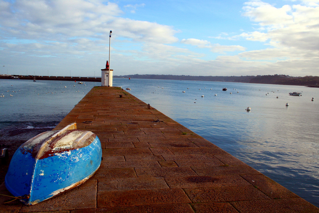
A jetty identified by its photographer as Conleau, in a January 2009 photograph. It illustrates a built shore edge, not the 1885 Barrarac’h slip, the proposed 1878 timber landing, or a verified present-day boarding point. Photo: gentlesound, Wikimedia Commons; CC BY 2.0. Unmodified by publisher.

The shore was part of the transport system
A boat alone could not provide the connection. The inventory’s study of Gulf landing slips explains why many were long and gently inclined: they accommodated the low coastal gradient and substantial changes in water level. Landings could include a level area for goods and steps at the outer end. It also describes the nineteenth-century network as converging on Vannes, an important place of supply and exchange. Inventaire général and Laboratoire GÉOMER, Cales de passage du golfe du Morbihan, IA56006418, Historique and Description.
This helps explain the investment at Barrarac’h without treating every slip as identical. A connection between two shores required a usable meeting point between the boat and the land journey. The built edge was therefore part of the route, not an incidental accessory to it. Nor does a surviving structure alone reveal how regularly it worked. Construction records can show an effort to improve a connection while leaving its daily rhythm largely undocumented.
Conleau became easier to reach by land
The Vannes shore was changing too. The Conleau inventory dates the purchase of the island for a seaside development to 1876 and records its connection to the mainland by a causeway following a ministerial decision in 1877. It also reports a request of 14 March 1878 for a timber landing stage intended for a steamship serving the resort and the Gulf. The supporting documentation is associated with departmental file S 1019. A proposal for a steamship landing is not proof that such a service subsequently ran, still less of its timetable. Inventaire général and Ville de Vannes, Station balnéaire dite Ile de Conleau, IA56003343, Historique and Illustrations.
Land access and water access were thus being developed together. The causeway did not make all nearby boat passages redundant: it connected Conleau to its own mainland shore, not to the opposite peninsula. That distinction matters when reading the landscape. A road can remove one break in a journey while leaving another to be crossed by boat.
The same passage served different purposes
Séné’s municipal heritage platform, Ti Anna, supplies a social account alongside the engineering history. Its page on the old slip describes fishing households using the passage to take produce to Vannes and townspeople crossing while out for a walk. Ville de Séné, Ti Anna, Cale de la pointe.
The contrast also changes how a journey to Vannes should be imagined. The boat crossing was a segment of movement, not necessarily a direct arrival at the city-centre port. Treating every reference to travel “to Vannes” as evidence of a boat running all the way there would erase the significance of Conleau as an intermediate shore connection. The distinction between a crossing and a complete journey is an inference from the named endpoints, not a reconstructed itinerary.
These details discourage two simplifications. The crossing was not necessarily either practical transport or recreation; different journeys could use the same connection. Yet neither a market journey nor a recreational outing identifies every service that used these shores. Ti Anna draws on published local history, the maritime inventory and residents’ knowledge, so it adds a municipal interpretation rather than a wholly independent archival confirmation.
The people and boats behind the connection
A separate Ti Anna sheet names women as well as men who operated passages. It identifies Marie-Jo Loiseau, born Grégam, as a boatwoman using a plate between Conleau and the point of Barrarac’h. Its accounts of other operators distinguish passages to that point from those towards Moréac or the Île-d’Arz. The sheet explicitly derives from Camille Rollando’s 1999 study; it is a later compilation, not a contemporary register. Ville de Séné, Passeuses et passeurs vers Conleau, l’Île-d’Arz et Arradon, one-page document.
The term plate is also more specific than “old ferry.” Ti Anna describes these as wooden, flat-bottomed boats used for several purposes, including carrying passengers, and relates their form to shallow water. Its accompanying photographic caption identifies a boatwoman on the Conleau–Barrarac’h passage. That does not establish the capacity, construction date or ownership of the pictured craft. Ville de Séné, Ti Anna, Plates et moj-pladoù.
Barrarac’h did not mean one unchanging slip
The twentieth-century story introduces an important separation between the old crossing place and later infrastructure. The inventory dates a new embarkation facility to 1968, when increasing traffic towards the Île-d’Arz had made the earlier slip inadequate. The inventory identifies renewed pressure to improve the infrastructure in 1978. Its survey describes concrete structures differentiated for passenger landings and vehicle loading. Inventaire général and Laboratoire GÉOMER, Embarcadère de l’île d’Arz, IA56006420, Historique and Description.
This island-related development belongs in the account only because it changed the mainland landing complex subsequently associated with the short Conleau crossing. It must not turn the latter into an island ferry. Ti Anna’s page on the newer embarkation point distinguishes the Petit Passeur from the passenger boats and freight barge serving the island. Its photographs and captions assemble these uses at one place without making them one service. Ville de Séné, Ti Anna, Embarcadère de Barrarac’h.
This is also why a replacement structure need not signify the disappearance of every older travel need. A larger facility could accommodate new traffic while the wish to reach the opposite shore persisted or later returned. The evidence here records rebuilding and a subsequent revival; it does not show that the short crossing operated continuously through those changes.
The practical historical lesson is that a place-name is not a fixed transport diagram. Reading an old photograph or account of “Barrarac’h” requires asking which landing and which destination it records.
What the local museum can establish
Vannes’s museum evidence reaches further back but answers a different question. The museum’s October 2024–March 2025 programme discusses medieval decorated floor tiles, including material from the episcopal manor of Conleau. Its illustrated tile bearing a ship is attributed to the ducal manor of Plaisance, not to Conleau. The museum presents such decoration in the context of elite residences and the expression of status. Musées de Vannes, October 2024–March 2025 programme, p. 8.
This material places Conleau within a longer inhabited landscape. It does not demonstrate a medieval ferry to Barrarac’h, and a ship motif is not a technical drawing of a local passenger boat. The distinction is productive: the museum preserves objects and their interpreted contexts, while the engineering summary documents a particular crossing centuries later. They should be compared without forcing them to certify the same claim.
A revived connection with a defined season
The modern Petit Passeur is a revival, not evidence of uninterrupted operation. Ti Anna dates its return between Barrarac’h and Conleau to 2018; the regional thematic inventory mentions the initiative that year but describes seasonal service from 2019. The exact first operating season is therefore left unresolved here. Neither account justifies extending a historical route automatically into the present. Ti Anna, Embarcadère de Barrarac’h; Inventaire général, IA56132141, Le goulet de Conleau.
For a dated operational statement, the agglomeration’s own page is more appropriate. It advertises the Conleau–Barrarac’h connection within a season running from 4 April to 13 September 2026. It presents the service alongside cycling, walking and a connection with the Kicéo bus network. The published season had ended before this article’s research date, 27 October 2026; the page is not evidence that a crossing was operating that day. Golfe du Morbihan–Vannes agglomération, Navettes maritimes saisonnières – Petits Passeurs, 2026 season.
Here the Gulf’s influence is precise rather than picturesque. A short water connection remains intelligible because of the shape of the shore, but geography does not determine its operator, landing arrangement or season. Those depend on investment and decisions about whom the service is intended to serve. Conleau’s passage is best understood as a repeatedly organised connection, not an unchanged survival and not simply a miniature cruise.
Locate the town
For regional orientation, open a Google Maps search for Vannes. This community-level search is not an exact building entrance, a verified walking route or permission to enter a workshop, museum or private property. Check the institution’s own current access information separately.