Free · France
Guérande: Salt pans and the work of salt harvesters
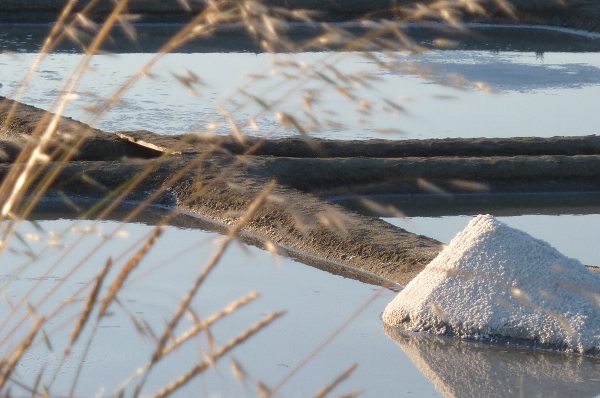
Guérande’s salt harvest is easiest to misunderstand when it is reduced to the moment someone lifts crystals from water. The more revealing subject is the place where that gesture happens: the œillet, the final crystallising basin within a saltworks. INAO, France’s origin-and-quality institute, identifies this basin as the principal summer harvesting place, but also emphasises the substantial work of clearing and consolidating the surrounding system. The harvest is an outcome of maintenance, not an alternative to it. INAO, Sel de Guérande ou Fleur de sel de Guérande, Le saviez-vous.
The locality also needs precision. Guérande is administratively in Loire-Atlantique, Pays de la Loire, in a historically Breton setting. The municipality itself distinguishes its present administrative location from its medieval Breton heritage. Nor does every reference to “Guérande salt marshes” mean ground inside this one commune: CapAtlantique distinguishes the Guérande basin from the separate Mès basin. Here the focus is the working basin and the labour that keeps it usable, with neighbouring Batz-sur-Mer providing the local museum evidence. Ville de Guérande, Guérande au cœur de la Presqu’île; CapAtlantique, Les marais salants.
A salt heap beside an œillet in the Guérande marshes, August 2010. The earthen divisions make the maintained workplace visible; this photograph does not establish the age of the basin or its annual output. Photo: Claire Maheux (Goodcityfordreamers), Wikimedia Commons; CC BY-SA 3.0. Unmodified by publisher.

A small basin connected to a larger system
CapAtlantique’s 2025 public-information leaflet labels the components of a saline separately: the sea, an étier or tidal channel, the water-control apparatus, a vasière, cobier, fards, adernes and finally the œillets. The vocabulary prevents the whole patterned expanse from becoming one undifferentiated “salt pan.” The harvesting area is one part of an organised water system, not a shallow pool that happens to contain seawater. CapAtlantique, Découvrez et respectez les marais salants, 2025 leaflet, p. 2.
This changes the question asked of the landscape. Instead of asking only where salt appears, ask what must remain connected and maintained for that place to produce it. A map of basins records spatial relationships; a photograph of harvesting records an action. Neither alone explains the whole job. Following the water makes the collector’s long-handled tool the end of a chain of work rather than its complete symbol.
An old unit of productive ground
The official regional inventory supplies a particularly useful archival comparison. In its discussion of the Redon cartulary, it describes an 870 sale involving the salines Penpont and Samoelil, together comprising forty capitellos with their associated dependencies. The inventory interprets these as crystallising units and compares their role in measuring productive property with that of œillets. The document therefore concerns organised working ground, not simply ownership of an indistinct wetland. Région Pays de la Loire, Inventaire général, Marais salants de Guérande, IA44003705, Du sel ignigène à la création des marais salants.
The distinction between a unit and its dependencies matters. The counted basins had value within an arrangement that included other necessary spaces. That is a useful historical counterpart to the modern separation of harvesting basin and water circuit. It does not prove that today’s boundaries, tools or working routines have remained identical since 870. The evidence used here is the inventory’s published reading of a medieval record, not a fresh examination of the manuscript. Its strongest contribution is to show that productive subdivision has a long documented history.
The earthwork behind the harvest
The Maison des Paludiers at Saillé brings the discussion back to work at ground level. Its account describes basins bordered by clay ponts, the earthen divisions within the saline. It places weeding and repairing these divisions within year-round maintenance, alongside heavier interventions such as clearing the vasière in some years. The same account links that preparation to the formation of surface fleur de sel and bottom salt in summer. Maison des Paludiers, La saline.
Read in this way, the straight edges and shallow compartments are maintained features, not permanent scenery. The word “natural” describes the role of evaporation; it does not mean that the workplace assembles or repairs itself. The earthen structure must keep doing its job while being exposed to the conditions on which production depends. This is why an account confined to summer gathering misses much of what makes a paludier’s work distinctive.
A different kind of civic document makes the maintenance visible in practical terms. CapAtlantique’s 2022 guide, prepared with salt-working and environmental organisations, lists cleaning of fares, adernes and œillets to prevent their floors from building up with mud and vegetation. It also identifies work on embankments and access to hydraulic controls. The guide addresses maintenance, explicitly not the restoration of abandoned salines. CapAtlantique and partners, Guide sur la prise en compte de la réglementation faune flore dans les marais salants de Guérande et du Mès, pp. 2, 4–5.
Two harvests within the same workplace
The distinction between coarse salt and fleur de sel is not simply a distinction between large and small grains. INAO explains that the former crystallises at the basin bottom, in contact with clay, while fleur de sel forms and is gathered at the surface. The difference is therefore already present in the œillet, before sorting or packaging. It requires attention to where the crystals form, not just to the finished product’s appearance. INAO, Le produit and Arômes et saveurs.
A producer’s account adds the corresponding tools: a las for coarse salt, a lousse for fleur de sel, followed by specially adapted wheelbarrows for moving the harvest. It also describes a variable season, usually beginning in spring or early summer when evaporation is sufficient, and potentially extending into September. This is an explanation by a commercial producer, not a measured calendar for every holding or evidence of the 2026 harvest. Sel de Ferme de Guérande, Production et récolte.
The two tools make sense as answers to two positions within the same basin. They also remind us that “harvesting” contains several operations: gathering is not the same task as moving material away. A still image of the tool over water can make the work appear self-contained when the producer’s account immediately continues to transport.
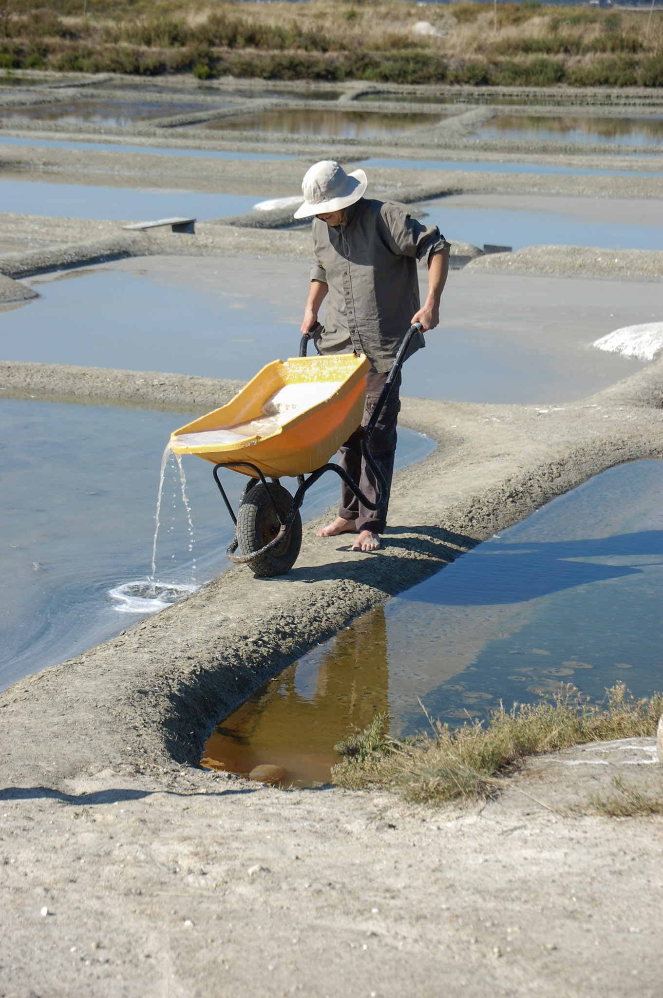
Moving salt in a wheelbarrow in the Guérande marshes, July 2012. Transport is a separate operation from gathering crystals. The worker is not identified here as either person portrayed in the museum paintings. Photo: Leocadieee, Wikimedia Commons; CC BY-SA 4.0. Unmodified by publisher.

What the local museum makes visible
The Musée des Marais Salants is at Batz-sur-Mer, not within Guérande town. Its history begins with Adèle Pichon, a daughter of salt workers who opened the Musée des Anciens Costumes in 1887. Alongside clothing, she collected tools, furniture and everyday objects as local ways of life changed. That origin is important: the museum’s subject was never merely the chemistry of salt. It connected working objects to the people who used and wore them. Musée des Marais Salants, Un musée à travers l’histoire.
A collection notice published in December 2025 offers a more individual view. It identifies Gérard Boulfray’s painting of Marc Nicol gathering coarse salt with a las, locating the scene in the Batz-sur-Mer marshes. This is a named person represented at work, rather than an anonymous figure standing for an entire occupation. The museum also describes a separate painting of Jean-François Lehuédé beside a substantial salt heap. Musée des Marais Salants, Une donation exceptionnelle, 11 December 2025.
These are the museum’s descriptions of artworks, not observations made during a harvest. Their contribution differs from that of the maintenance guide. The paintings preserve an interpreted gesture and a worker’s identity; the civic document records operations that an attractive harvesting scene may leave outside the frame. Reading them together restores both person and preparation without making a painting into a technical manual.
Hand harvesting does not exclude other machinery
The 2022 maintenance guide lists motor pumps and excavators alongside manual tools for particular operations. It also explains that work has to take account of protected species and nesting periods. This is not a contradiction of hand harvesting: collecting salt and maintaining the larger water system are different tasks. Nor is the guide a blanket permission to undertake works; it expressly leaves responsibility for complying with the relevant protections with those carrying them out. CapAtlantique and partners, maintenance guide, pp. 2–5.
The museum offers another useful boundary. Its published route describes former commercial premises containing a salt-washing operation active from 1914 to 1962. That industrial history belongs downstream of the œillet. A machine used in processing does not establish mechanical harvesting, just as a hand tool does not establish that every later stage was manual. Keeping the stages separate avoids turning “traditional” into a claim that nothing ever changed. Musée des Marais Salants, Parcours de visite.
The individual pan depends on shared infrastructure
The œillet is a useful scale for understanding work, but it is not the right scale for every intervention. At Bérigo, in neighbouring Batz-sur-Mer, CapAtlantique describes a hydraulic structure that regulates water levels and helps protect homes and salt holdings from marine flooding. Its account identifies an owners’ association as the proprietor and the agglomeration as the body entrusted with the repair operation. Work on the structure and adjoining embankments is therefore a collective undertaking, not simply a task for the person gathering salt. CapAtlantique, Bérigo, un chantier majeur pour protéger les biens et les personnes dans les marais salants.
Bérigo is one named installation, not an explanation of every saline’s water supply. Nevertheless, it exposes another limit of the solitary-harvester image. Individual skill operates inside a maintained territory whose larger structures require their own organisation. The person at the œillet and the institutions responsible for major works occupy different positions within the same working landscape.
Preserving the ability to work
The museum records the inclusion of the peninsula’s salt-working practices in France’s national inventory of intangible cultural heritage in 2024. Its explanation stresses practices and knowledge that communities continue, adapt and transmit. This is national inventory recognition, not a claim that the salt pans have become a UNESCO World Heritage property. It directs attention to the ability to keep working, not merely to the retention of an old-looking landscape. Musée des Marais Salants, Préserver le savoir-faire salicole traditionnel.
That ability is what ties the evidence together. The medieval record counts productive units; the contemporary maintenance guide makes their upkeep explicit; the museum gives the work objects, images and individual identities. At the scale of the œillet, Guérande’s heritage is neither an unchanged medieval survival nor a summer performance. It is the repeated work needed to make a small piece of clay-lined ground productive again.
Locate the town
For regional orientation, open a Google Maps search for Guérande. This community-level search is not an exact building entrance, a verified walking route or permission to enter a workshop, museum or private property. Check the institution’s own current access information separately.