Free · France
Chartres: How market streets link the town to Beauce farming
The most useful way to connect Chartres's market streets with the surrounding countryside is to follow the handling of food, rather than simply its display. A sack arriving from a farm had to be unloaded, placed, measured, sold and accounted for. A present-day stall also needs an authorised place and a way into the pedestrian centre. Between those two situations lie substantial changes in trade, transport and farming. The surviving squares do not preserve one timeless market. They offer several different kinds of evidence about how agricultural goods became urban business. Place des Halles, place Billard and place de la Poissonnerie should therefore be read together, but not treated as different names for the same site or as interchangeable stages in a single uninterrupted tradition.
A market floor, and the work upon it
Archaeology gives place des Halles a history below the visible street surface. Dominique Joly's report on rescue excavations in 1978–1979 describes successive paved levels, made with flint, brick and broken tile. Written evidence, as reported by the excavator, places a market there by at least the thirteenth century. Two timber halls were repaired in 1530 and demolished in 1584; the square then remained uncovered. This is an important qualification to the name. A place called “Halles” need not retain a roof over its trading ground. The report also distinguishes evidence from interpretation: dark soil below the market surfaces might represent gardens or an intentional deposit of cultivated earth. It does not warrant confidently reconstructing a particular garden. For the market story, the strongest point is the repeated making of a usable ground surface. Agricultural exchange required an urban working floor, not merely an empty space between houses. Dominique Joly's excavation report
The people organising that floor become visible in a local historical study published by the city. Juliette Clément's account, drawing on Paul Mollé's research, describes the leveuses de cul-de-pouche, women whose status at the grain market was officially recognised in the eighteenth century. Their work included managing unloading, positioning sacks, arranging measurement and payment, and accounting to farmers or owners. The cited account explains the name through lifting a sack so grain settled during filling; the responsibilities went well beyond physical assistance. These women worked in societies, but the article explicitly distinguishes those societies from recognised corporations. Their position was therefore neither simply casual labour nor a guild office to be assumed from the name. The city also scrutinised their charges and accounts. Here, the countryside's relationship with Chartres takes a precise human form: sellers could entrust goods and money to intermediaries who knew the market's procedures. That relationship depended on practical competence and confidence in an account, not only on proximity to fertile land. SAEL study in Votre Ville, December 2010, p.35
What an absent notebook can still establish
One tempting source cannot be read as a surviving price series. The Catalogue collectif de France records manuscript Ms 1633, entitled Prix du grain sur le marché de Chartres, covering 1691–1778. Its description specifies a paper notebook of forty-nine leaves. It also states that the manuscript was destroyed when the library was bombed on 26 May 1944. The catalogue preserves knowledge that such a record existed; it does not supply its lost entries. No particular price rise, harvest crisis or farmer's income can responsibly be extracted from the title alone. Nevertheless, the object described is significant. Grain exchange generated information worth recording over time, not just the momentary noise of a market day. Set beside the account of the leveuses, the notebook points towards the importance of calculation and recordkeeping. Its destruction also explains why a vivid reconstruction of the square must not pretend that every part of its commercial history remains available for inspection. CCFr catalogue record, Ms 1633
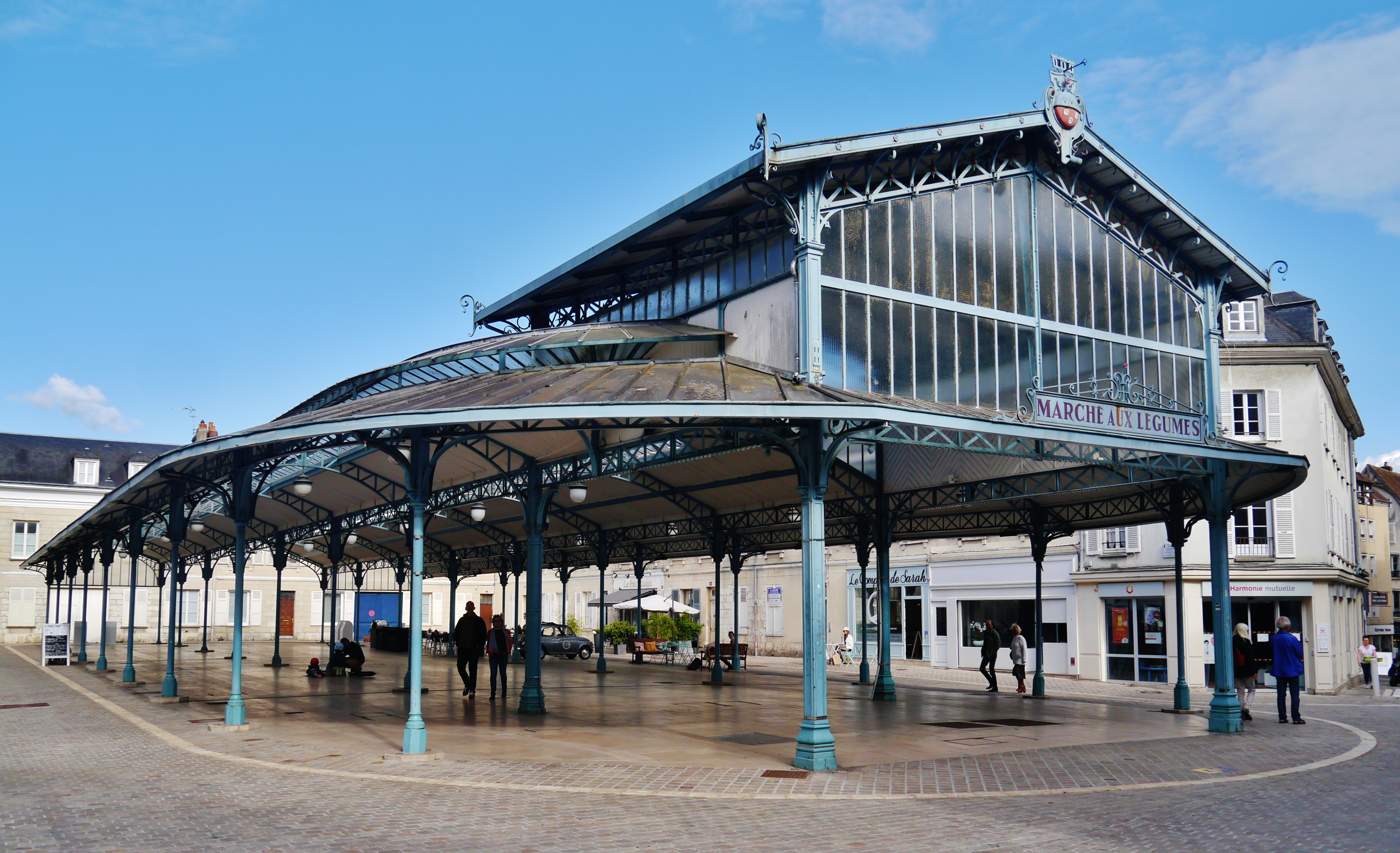
Place Billard presents a different sequence. The city's heritage account describes the disappearance of the counts' castle, the subsequent vegetable market and the construction of the covered hall in 1899. Its reference to a “Baltard” type of architecture is a stylistic description, not an attribution of the building to Victor Baltard. The conversion of this site is the essential point: ground formerly associated with political authority acquired a practical role in provisioning the town. The roof is later than the establishment of vegetable selling there. Thus, neither the market's use nor its architecture should be assigned one undifferentiated medieval origin. Reading Billard alongside place des Halles reveals contrasting arrangements—an uncovered grain-market ground and a later covered vegetable market—rather than a single picturesque institution. The differences help explain how the town accommodated commodities with different handling and selling requirements, without proving that every trader or product came from Beauce. City heritage account of place Billard
The covered vegetable market on place Billard, photographed on 15 June 2019. This is not the historical place des Halles discussed earlier. The view documents the market building, not the origin of goods, the occupations of passers-by, or today's trading arrangements.
Photo: Zairon, Chartres Place Billard Marché aux Légumes 1.jpg, CC BY-SA 4.0. Original photograph reproduced without cropping or other alteration.

Space was negotiated, not simply inherited
The municipal archives' presentation of place de la Poissonnerie brings planning decisions into the picture. Fish selling is documented there from the fifteenth century. In 1869 the council voted to acquire neighbouring property to enlarge the space. A proposed auction market and hall in 1873–1874 did not proceed because funding was lacking. These are separate outcomes: an enlargement decision should not be mistaken for completion of the later building proposal. The archive also records repeated consideration of sanitary facilities in response to the neighbouring Billard market. Such details change the interpretation of an attractive square. Crowds and goods created needs for room and hygiene that had to be addressed administratively. Fish also prevents the food district from becoming a simplistic illustration of cereal-growing Beauce. Chartres's markets assembled different provisioning networks. The countryside connection was important, but it was not the only geographical relationship expressed by the streets. Municipal archives: changing place de la Poissonnerie
Today's municipal market page describes another negotiated arrangement. It places the Saturday food market at Billard and Poissonnerie and the Wednesday market on boulevard Chasles. For Billard's exhibitors, access is through controlled entrances at place des Épars and rue Saint-Michel. The page distinguishes access for setting up and packing away from the period of selling. These details are more informative than a claim that the old centre simply “comes alive.” A pedestrian shopping environment and vehicle-dependent deliveries occupy the same streets at different times. Municipal organisation makes their coexistence possible. This is not practical arrival advice: arrangements can change, and the city's operational page should be checked for current use. Nor does permission to trade certify where a product was grown. The present market is evidence of an organised urban food interface, not proof that every stall reproduces an earlier farmer-to-town exchange. City of Chartres market arrangements
Beyond the visible stall
Le Compa supplies a necessary comparison with the work before food reaches town. Its permanent exhibition follows operations such as ploughing, sowing and harvesting, while other sections consider rural society, representations of farmers and contemporary technical change. The machinery is therefore not simply a collection of imposing objects. Arranged as a sequence of operations, it exposes processes that a market display conceals. A stall presents saleable food; a museum can restore attention to the labour and equipment behind it. That comparison does not identify a particular machine as the source of grain sold at place des Halles. The museum's stated interpretation is broader than this one square. Its value here is to prevent market history from beginning only when a cart or delivery vehicle enters Chartres. Urban exchange was one part of an agricultural process, and the visible product was already the outcome of numerous decisions and tasks. Le Compa's permanent exhibition
The museum's Moisson express exhibition extends the comparison through its own railway-roundhouse setting. It connects steam power in transport and agriculture, moving from local history towards a wider French account. The roundhouse gives this interpretation a material starting point outside the old market squares. Goods and people could be organised through infrastructures whose scale differed sharply from a sack on a market floor. The exhibition description does not establish the route of a particular Beauce consignment, or prove that railway development alone ended an older trading practice. It does, however, make it harder to imagine the relationship between Chartres and farming as permanently confined to its historic streets. Those streets belong within a changing transport landscape. Their continuing food trade is one surviving form of connection, not a complete map of the agricultural economy. Le Compa: Moisson express
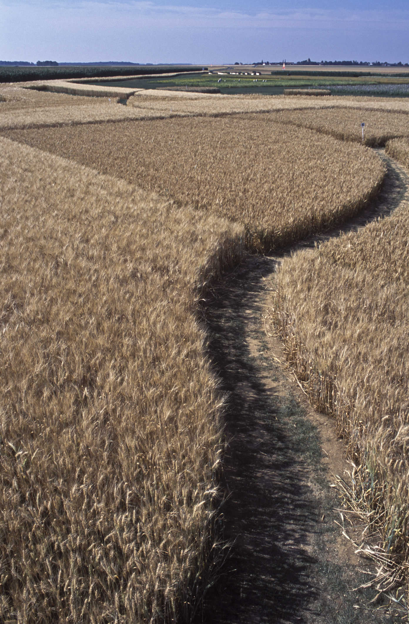
Wheat fields in Beauce, as identified in INRA's image record. The exact farm and capture date are not established here; this regional context is not evidence that these plots supplied Chartres's markets or belonged to the short-chain farms counted in 2022.
Photo: Jean Weber / INRA DIST, Champs de Blé dans la Beauce, CC BY 2.0. Original photograph reproduced without cropping or other alteration.

A territorial food diagnosis provides the final corrective. Chartres Métropole's document describes a landscape suited to large-scale arable crops, while its November 2022 diagnostic section separately counts thirty-nine farms using short supply chains. That dated figure concerns the metropolitan territory, not the number of producers at Billard, and cannot be presented as a 2026 total. More importantly, the distinction shows why agricultural abundance around a town does not automatically mean that nearby residents obtain all their food directly from nearby farms. Production, processing and distribution are different questions. The market streets make one part of that system unusually visible: the meeting between goods, sellers, buyers and municipal space. Their history is most convincing when measured at that scale. From market surfaces and delegated accounts to controlled delivery access, Chartres's link with Beauce has been made through work and organisation, not simply through the view of fields beyond the town. Chartres Métropole territorial food diagnosis
Location orientation
Chartres — general town map search provides orientation only, not verified market access, a delivery route or current trading arrangements.
Source register and editorial boundaries
- Joly, Archéologie médiévale 10 (1980), pp.368–369: excavation report; opened text distinguishes observed surfaces and interpretation.
- SAEL, Votre Ville 96 (December 2010), p.35: author-read PDF; synthesis, not original accounts.
- BnF/CCFr, Ms 1633: catalogue HTML downloaded and inspected after browser cache failures; records destruction, not accessible price entries.
- Chartres en lumières, place Billard: municipal historical interpretation. Its market-day wording differs from the operational market page; no schedule is taken from it.
- Chartres municipal archives, Poissonnerie: documentary presentation; proposed hall distinguished from completed work.
- Chartres, markets: current operational page checked 27 October 2026; no provenance audit or attendance inference.
- Le Compa, permanent exhibition: museum interpretation, not proof that individual collection objects supplied Chartres markets.
- Le Compa, Moisson express: exhibition description and railway setting; no consignment route inferred.
- Chartres Métropole, territorial food diagnosis: PDF downloaded and text inspected; short-chain figure explicitly dated November 2022. Action proposals are not treated as achieved results.
Remaining gaps: no original leveuse accounts, market-origin survey or surviving Ms 1633 entries examined. Historical place des Halles is kept distinct from Billard. Source-based interpretation does not imply an unchanged market system or exclusively Beauce-grown contemporary stock.