Free · France
Bourges: Historic core, marsh gardens and water channels
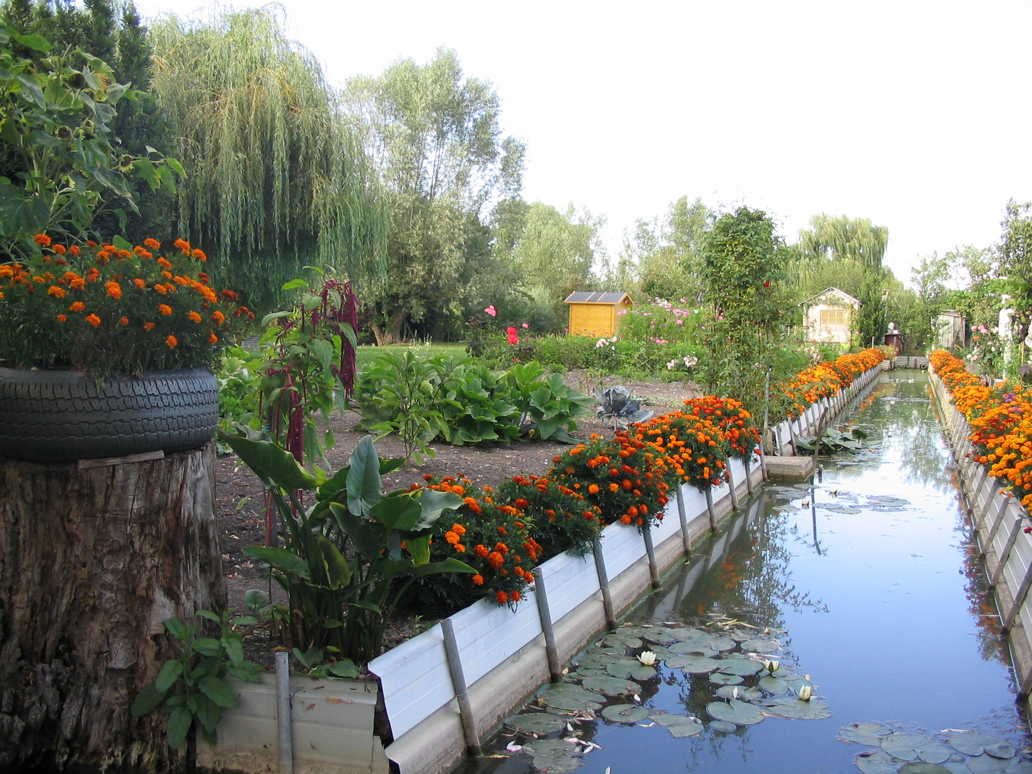
A narrow watercourse between two vegetable gardens can look like a boundary. In Bourges's marshes it is also part of the equipment that allows the gardens to exist. Following one of these divisions changes the relationship between the historic town and the green ground below it. The garden is not simply a pleasant foreground to the cathedral, and its water is not an incidental reflection of the monument. The channel belongs to a connected, maintained landscape. Its condition raises questions about work, neighbours, access and responsibilities that a distant view cannot answer.
A garden edge that belongs to a wider system
The Cher departmental archives’ teaching dossier describes a nineteenth-century hydraulic transformation: construction of the Grand canal de dessèchement and the Quatre pelles reservoir helped drain the marshes and regulate flooding. It then recounts journalist Ardouin-Dumazet’s 1901 visit by boat through a network of channels and private gardens, with gardeners carrying vegetables and flowers in flat-bottomed boats. These historical accounts connect cultivated plots with infrastructure and transport rather than treating water as scenery. They do not establish today’s flow routes, operating arrangements or navigation permissions. Read alongside the municipal archive inventory’s maintenance disputes, they suggest a useful distinction: cultivating an individual garden and sustaining the water system around it are related but different tasks. Cher departmental archives, teaching dossier, fiche 6
The city's historical overview puts cultivation within a sequence of changing uses. Wet ground around Bourges served a defensive purpose before becoming the familiar garden landscape. In the seventeenth century, Jesuits acquired part of the marshes and leased it to people who converted land into cultivable plots. Cultivation intensified after the Revolution and the sale of national property. Professional growers supplied the town, but that occupation declined during the twentieth century and disappeared locally in the 1970s, according to the municipal account. Family gardens subsequently became the predominant use described by the city. The contrast matters: vegetables growing today do not prove the survival of the same commercial livelihood. An inherited parcel pattern can continue to shape daily practice after the economic organisation that produced it has changed. The connection with the old town is consequently more than visual, but it is not an unchanged supply arrangement. City of Bourges: marsh history
Garden plots beside a channel in Bourges, August 2005. The view makes the close spacing of cultivated ground and water tangible; it does not identify a present owner, establish the direction of flow or grant permission to enter. Photo: M. Weinert (Takamine), original and photographer's public-domain release, via Wikimedia Commons. Unaltered.

Water leaves a paper trail
The municipal archive inventory provides an antidote to the idea of permanently tranquil water. File 3 O 29 includes records of an official inspection of flooding in 1795, requests concerning an old aqueduct in 1823, drainage disputes and later arrangements for canal maintenance and charges. Nearby file 3 O 30 concerns mill weirs, cleaning of mill channels and investigations of water levels. These are catalogue descriptions, not the full petitions or reports. They establish the subjects and existence of documentary files; they do not settle who was right in an individual dispute. Even at that level, the evidence is revealing. Water in and around the marshes required inspection, negotiation and expenditure. The garden channel participated in a world that also included mills, urban authorities and organised landowners. The present concern with collective maintenance is not an entirely new problem imposed on an otherwise self-sufficient rural enclave. Bourges municipal archives, series 3 O
A different paper trail records how gardeners organised themselves. The Association des Maraîchers de Bourges describes its formation following opposition to a proposed authorised syndical association in the late 1990s. Its history then identifies cleaning days for channels and paths among the activities developed by the newer organisation. This is the association's own account, not a neutral verdict on the earlier disagreement. It is useful precisely because it preserves an institutional memory of dissent as well as cooperation. Shared dependence on water did not automatically produce agreement about how to govern it. The same group could resist one organisational form while supporting collective work through another. That distinction prevents “community” from becoming a comforting but empty label. In these gardens, cooperation has had to acquire a form that participants could accept, and maintenance has remained a tangible activity rather than simply a statement of attachment to the landscape. Association des Maraîchers de Bourges: institutional history
Caring for a channel is not the same as agreeing about it
The city's 2022 Assises page records a more recent attempt to bring different interests into discussion. Workshops addressed preservation, water management, access, heritage and the relationship between town and marshes. The municipal presentation explicitly acknowledges that views gathered before the meetings could diverge. It also records a public meeting rather than presenting consultation as a private exchange between officials and owners. The significance is not that discussion necessarily solved the problems. A programme, attendance record or summary cannot demonstrate a restored bank or a sustainably funded maintenance system. Instead, the process shows that the marshes were being considered simultaneously as cultivated property, an ecological setting and a place encountered by the wider town. The small channel is where those concerns become difficult to separate: its clearance may affect access, water movement and living organisms together. City record of the 2022 Assises
The preparatory interview synthesis makes the practical tension more explicit. Participants described the difficulty of removing green waste from plots accessible only by boat, followed by transfer into a vehicle. They also raised the risk that an increasingly individual, recreational use of plots could weaken attention to collective upkeep. These are reported perceptions, not a census of negligent gardeners. Their value lies in identifying a particular chain of work. Cutting vegetation is only one stage; moving the cut material out of the marshes can require several handling operations. The channel is therefore both something to maintain and, for some plots, part of the route by which maintenance becomes possible. An apparently modest garden task can depend on equipment, physical effort and coordination beyond the plot itself. This offers a more concrete explanation of vulnerability than simply blaming change or praising earlier generations. DialTer's June 2022 interview synthesis, especially pp.6–12
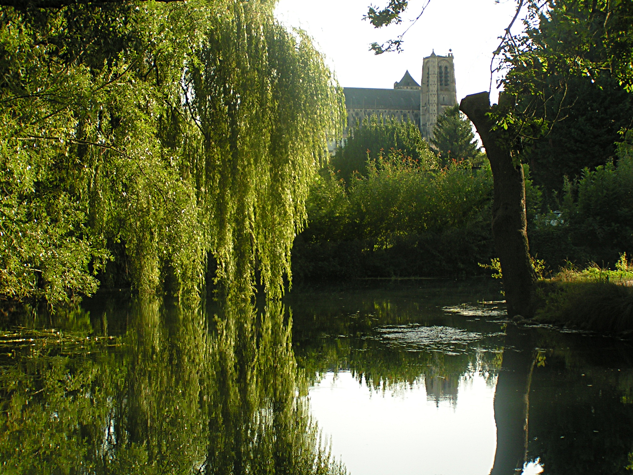
Bourges Cathedral beyond the marsh vegetation and water, 13 August 2009. The juxtaposition connects the garden landscape visually with the historic town, but cannot measure ecological condition or establish today's public routes. Photo: Domenico Di Nolfo (Mimmo D.DN), CC BY-SA 3.0, original and rights record, via Wikimedia Commons. Unaltered.

A cultivated view is not an ecological measurement
Museum-related evidence complicates the attractive image of lush gardens. A research report hosted by Caisse des Dépôts, based in part on fieldwork in Bourges, relays the natural history museum's concern that the marshes' biodiversity is lower than might be expected for such a wetland. The report discusses past observations of birds and bats, but the original monitoring dataset has not been examined here. It would therefore be wrong to turn that account into a current species count or a proven diagnosis of a particular gardener's practices. The narrower lesson is still important: abundant greenery and visible cultivation do not measure ecological health. The museum's perspective, as reported by the researchers, asks different questions from those posed by a person seeking a productive vegetable plot or a beautiful view. Keeping those perspectives distinct makes their comparison useful rather than forcing them into a reassuring claim of perfect harmony. Research report, Bourges case study, printed p.74
The city's museums and heritage directorate supplies a second, different distinction. Its presentation lists the cathedral's World Heritage status separately from the historic centre's heritage designation and the protected natural site of the Yèvre and Voiselle marshes. These are not interchangeable labels. Seeing the cathedral from the gardens does not make every plot part of the cathedral's World Heritage property. Nor should the marshes be confused with the nearby Prés-Fichaux garden, which the same page identifies under a different garden label. The institutional categories clarify the physical relationship: historic buildings, cultivated wet ground and designed public gardens coexist within Bourges, but their histories and conservation frameworks differ. For an account centred on channels, this is a useful restraint. The marshes need to be understood through their own working structure, rather than borrowing significance from the monument that happens to dominate many views. Bourges Museums and Historic Heritage Directorate
A way into the place, without turning every path into an invitation
The growers' association describes guided walks along the Yèvre and Voiselle embankments. It explicitly says its own visits are on foot, not by boat, because it lacks the necessary authorisation and safety equipment for that activity. This is evidence about one organisation's offer, not a claim that no other operator can ever provide a boat visit. The distinction is particularly apt in a landscape where water serves several roles. A channel navigated for work is not automatically a public excursion route, just as the sight of a productive garden is not permission to enter it. The association's interpretation also gives the embankments a role in explaining the place. From a shared route, the arrangement of plots and water can become legible without requiring access to every cultivated surface. Association des Maraîchers de Bourges: its guided visits
Bourges's marshes are thus most revealing at their edges. A bank separates land and water, but also joins the gardener's task to a wider set of dependencies. Archive descriptions show earlier arguments and obligations; local organisations describe collective work; consultation records reveal practical obstacles; museum-related evidence challenges an easy equation between green scenery and ecological success. None alone supplies the complete history of a channel. Together they explain why the gardens belong to the life of the historic town without being merely its backdrop. Their inheritance is not only a view worth preserving. It is an arrangement that must continue to function.
Location orientation
Bourges — general town map search is for orientation only, not permission to enter a garden or navigate a channel, or a verified accessible route.
Source register and editorial boundaries
- Cher departmental archives, teaching dossier, fiche 6: historical hydraulic works and the dossier’s account of a 1901 visit; webpage inspected, underlying historical documents not examined.
- City marsh overview: historical interpretation; change from professional growing to family gardening.
- Municipal archives 3 O inventory: indexed catalogue entries checked; original petitions, inspection reports and water-level records not examined.
- Association des Maraîchers de Bourges history: first-party institutional memory; disputed institutional history attributed to the association.
- Municipal Assises page: documented consultation process, not proof of completed improvements.
- DialTer interview synthesis, June 2022: city-commissioned stakeholder evidence; concerns and perceptions not converted into measured outcomes.
- Caisse des Dépôts-hosted research report, Bourges case study: original fieldwork report relaying the Muséum's perspective; underlying museum monitoring data not inspected.
- Museums and Historic Heritage Directorate: distinct heritage categories; no extension of cathedral World Heritage status to all gardens.
- Growers' association visit page: that operator's stated scope only, not universal boat-access advice.
The revised marshes charter could not be verified in this check and is not used in the current article. Earlier authoring claims and removed wording are preserved in the QA evidence.
Remaining gaps: no original historical hydraulic files or contemporary museum species dataset examined. Conflicting area totals and exact protection-day wording across sources are not resolved or used. Museum atlas and eco-guard pages could not be opened; the tourism boat page returned 403, so none supports manuscript claims. No access workaround was attempted. Current navigation, ownership permissions and works requirements require direct local verification.