Free · France
Saint-Omer: Marshland market gardening and canals
A channel has more than one job
In the Audomarois marsh beside Saint-Omer, water separates cultivated plots but also connects them. A channel may be part of the drainage system, an approach to a holding and a route along which a harvest once travelled. These functions should not be collapsed into a single picturesque image of vegetables surrounded by water. The narrow question here is how access to growing land changed when boats, roads and managed water levels had to serve the same agricultural landscape.
The Conservatoire du littoral describes a deeply divided pattern of landownership shaped by several activities: market gardening, livestock farming, peat extraction, hunting and fishing. Its account treats the marsh as a human-made landscape requiring active management, not an untouched wetland accidentally containing farms. Saint-Omer is the urban reference point, but the wider marsh crosses municipal boundaries. Conservatoire du littoral, Marais Audomarois
That geography matters. An account of Saint-Omer's gardening heritage cannot assume that every field, waterway or interpretive building associated with the marsh lies inside the city itself. Nor can one kind of plot stand for the entire wetland.
Reading a working boat through its sides
The bacôve is commonly introduced as the larger traditional boat and the escute as its smaller companion. A 2025 interview with Saint-Omer boatbuilder Rémi Colin, published by the regional natural park, offers a more precise distinction. He explains that the escute has a single side plank, while the bacôve adds overlapping planking above it. Raising the sides increased the boat's capacity to carry produce. Size alone is therefore an unreliable way to distinguish the two forms. Parc naturel régional des Caps et Marais d'Opale, Journal des habitants no. 65, printed p. 10
This small construction detail shifts attention from silhouette to work. The boat was shaped around the problem of carrying a load through the marsh. It should be understood alongside the cultivated bank, the point of loading and the route onward, rather than as an isolated folkloric object.
The same interview warns that irregular demand threatens the transmission of boatbuilding skills. Keeping a vessel in view and keeping the ability to make another are different achievements. A surviving shape is not, by itself, proof of a secure working tradition.
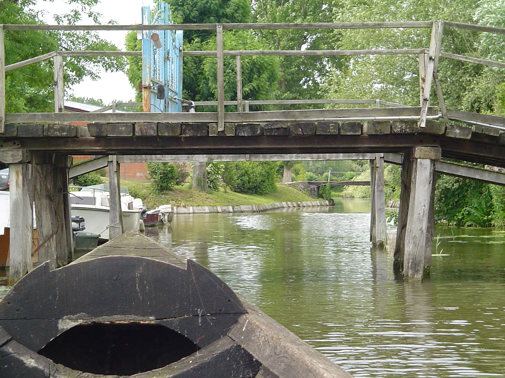
A waterway in the Audomarois marsh on 29 May 2004, seen from a boat beneath a timber footbridge. The view makes the meeting of waterborne movement and a crossing visible; it does not identify a particular consolidation project, boat type, crop cargo or present-day access right. Photo: Hagen de Merak, Wikimedia Commons; CC BY-SA 2.5. Unmodified by publisher.

Roads brought access, but not one shared verdict
The park's oral-history compilation, Parcelles de marais, parcelles de mémoire, preserves sharply different recollections of land consolidation. Jacques Berteloot recalls promoting consolidation at Lyzel because scattered plots were difficult to reach. Fernand Delobel remembers resisting a proposal to fill the ditch through which he could bring his boat home. These are attributed recollections, not findings from a legal investigation. Regional natural park, Parcelles de marais, printed pp. 30–32
The publication places the principal changes in successive phases from 1971–72 to 1983–84. New access roads, bridges and regrouped plots helped motorised equipment reach land previously organised around waterways. Its account also notes that some reorganised ground moved from vegetables towards cereal production.
The contrast is more revealing than a simple story of progress replacing backwardness. A road could solve one grower's difficulty while the loss of a ditch threatened someone else's established access. The same alteration could preserve cultivation yet change which crops were grown. This memory record makes disagreement part of the heritage: the marsh's characteristic form was negotiated, not universally cherished in exactly the same way.
A drainage machine, not a flour mill
The Moulin de l'Aile displayed at the Maison du Marais gives another entry into that working landscape. The centre describes its Archimedes screw as a device for draining cultivated land. It was installed in the centre's park for the opening in 2014. Its presence there should therefore not be read as evidence that it has always occupied this particular setting. Maison du Marais, park and conservation garden
The important distinction is functional. A windmill can move water rather than grind grain. In this case, its interpretation makes visible the effort needed to separate a workable growing surface from the water around it. The mechanism links the crop to a larger hydraulic arrangement.
This is a useful corrective to the idea that fertile ground needs only planting and harvesting. Access by boat is one problem; waterlogged ground is another. A vessel moves people or goods across water, whereas a drainage machine changes the relation between water and soil. Both belong to the same cultivation system, but they do different jobs.
The grower becomes a museum narrator
The Maison du Marais's Chez Capiau exhibition frames the subject through Yves “Capiau” and a final working day before retirement. The operator describes family photographs, tools and films as part of the presentation. It also identifies the renewed 2025 scenography and actor Benoît Allemane's voice as elements of the narration. The published address places the centre in neighbouring Saint-Martin-lez-Tatinghem, despite its close association with Saint-Omer. Maison du Marais, Chez Capiau
That combination requires a careful reading. The display brings personal objects and recollections into a deliberately constructed visitor experience. Its narrative voice should not automatically be mistaken for an unedited oral-history recording. Equally, theatrical interpretation does not make the material objects irrelevant: a tool and a family photograph can direct attention to work otherwise hidden behind a landscape view.
The exhibition and the park's testimony collection answer different questions. One builds a coherent encounter for visitors; the other allows incompatible memories to remain beside one another. Reading them together avoids making one representative gardener speak for every household.
Water management remains a practical dispute
CAPSO's April 2022 report on maintaining agriculture in wetlands examines hydraulic compartments whose water levels can be managed separately from the general waterbody. It records a 2019 soil-training session on Saint-Omer's communal marsh and tensions among growers with differently situated plots or houses. Lowering water to facilitate cultivation can expose peat to degradation; the report treats the soils' variability as a reason for further investigation. CAPSO, PMAZH review and action plan, printed pp. 31–35
Importantly, the document does not present all its evidence as settled. It says that satellite observations pointing towards general subsidence had not established statistical significance over the study period. Proposed monitoring and consultation should not be rewritten as completed solutions.
For the heritage story, the consequence is straightforward: drainage is not simply an old technique that modern equipment has perfected. Decisions still involve trade-offs between cultivation, soil conservation and neighbouring interests. There is no single water level that this manuscript can responsibly prescribe for the marsh, and no basis here for declaring every compartment equally vulnerable.
A passenger is not a crop load
The Maison du Marais now offers interpreted journeys in bacôves. Its own account presents the boat as a means of explaining the marsh's environment and inhabitants. That establishes a contemporary cultural use, not a claim that tourist trips reproduce the former working day of a market gardener. Maison du Marais, traditional boat interpretation
The distinction matters at the bank. For a grower, a boat's usefulness depended on reaching the plot and moving what the holding produced. For a visitor, its usefulness may be the viewpoint and the explanation it makes possible. The shared vessel form can connect those experiences without making them identical.
Nor should the availability of a guided journey be read as permission to use every ditch. A public-facing interpretation service is not a map of unrestricted access to private cultivation. Understanding the agricultural landscape includes recognising that its attractive edges remain workplaces and boundaries, not merely scenery laid out for spectators.
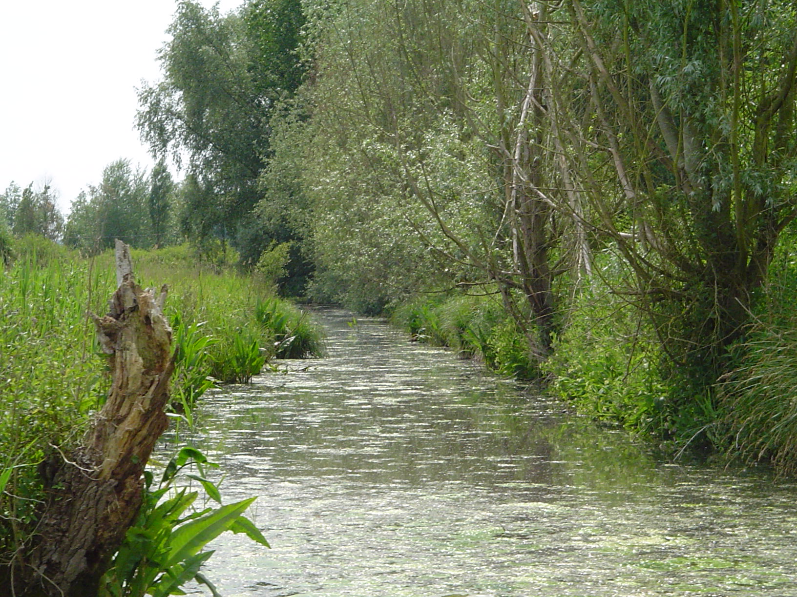
A narrow, vegetated channel in the Audomarois marsh on 29 May 2004. The image illustrates the close boundary between water and bank vegetation, not a measured water level, drainage performance or current navigability. Photo: Hagen de Merak, Wikimedia Commons; CC BY-SA 2.5. Unmodified by publisher.

Conservation does not mean walking away
The Conservatoire's management account identifies maintaining open habitats and managing water among its objectives. It describes measures including mowing, extensive grazing and removing woody growth, while favouring continued agriculture and measured public access. These are the land manager's stated approaches on the areas where it intervenes, not an instruction for every landowner in the marsh. Conservatoire du littoral, management account
This introduces a further distinction between abandonment and protection. A cultivated wetland cannot be understood only through the opposition of human activity and nature. Some of the open landscape valued today depends on recurring intervention. The question is which work sustains which habitat and use, and under whose responsibility. It is therefore misleading to imagine that losing agricultural activity automatically restores an earlier, more authentic marsh. The sources instead describe choices among different possible futures for already altered land and water.
What survives between the plot and the water
The strongest account of this marsh keeps several forms of evidence in play. Boatbuilding knowledge explains a practical object. Recollections of consolidation expose competing interests. A displayed drainage mechanism makes water control visible, while the agricultural report shows why that control still raises difficult questions.
Together, they challenge the idea that preservation means holding the landscape at one ideal date. Some changes made farms easier to reach while reducing dependence on boats. Other changes have turned working objects into teaching tools. Neither process makes the earlier labour disappear, but both alter what can be learned from what remains.
Saint-Omer's marshland gardening heritage lies in that relationship between soil, access and water. The canal is not merely a border around a vegetable plot. It belongs to the history of how people reached the land, moved its produce and argued over the conditions that made cultivation possible.
Location orientation
Saint-Omer, France — general map search. This town-level orientation does not locate every holding in the wider Audomarois marsh or establish field, waterway or visitor access. The interpretation centre discussed above is in Saint-Martin-lez-Tatinghem.
Source register
All sources were opened and consulted on 27 October 2026. French sources are paraphrased in original English.
- Conservatoire du littoral, Marais Audomarois. Public land-manager description; wider marsh and protected holdings are not equated.
- Regional natural park, Journal des habitants no. 65, September 2025, printed p. 10. Interview with practising boatbuilder; construction distinction and transmission concern.
- Regional natural park, Parcelles de marais, parcelles de mémoire, printed pp. 30–32. Edited oral-history record and consolidation summary; not original case files.
- Maison du Marais, park and conservation garden. Operator's account of the relocated mill and its drainage function.
- Maison du Marais, Chez Capiau. Exhibition format, 2025 renewal and actual institutional address.
- CAPSO, PMAZH review 2019–2021 and action plan 2022–2024, April 2022, pp. 31–35.
- Maison du Marais, traditional boat interpretation. Current operator description; no operational advice or timings adopted.
Evidence limits
- No farm census, current crop-area estimate, original consolidation files or access-rights investigation. Individual memories retain attribution and are not adjudicated as universal fact.
- The local library's historic-postcard record could not be opened successfully and is not used. The archival component is the park's opened oral-history publication, not a claimed inspection of original recordings or photographs.
- No blanket “last market-gardening marsh in France” claim, simplified medieval origin story, UNESCO World Heritage claim or boat-loading instructions. The centre is correctly located in Saint-Martin-lez-Tatinghem.