Free · France
Saint-Jean-Pied-de-Port: Border settlement customs across the passes
A mountain pasture can look continuous even where a national boundary crosses it. For the communities around Saint-Jean-Pied-de-Port, making that landscape usable has involved agreements, seasonal decisions and repeated contact with neighbours on the other side. The border's social history is written partly in those arrangements.
One enduring example is the relationship between Cize, or Garazi, and Aezkoa. The Aezkoa valley's own public information describes an annually signed grazing agreement accompanied by a gathering of shepherds and livestock keepers. A meal and celebration surround an arrangement with a practical purpose: deciding how neighbouring communities share access to pasture. Aezkoa valley: Día de la Facería.
This is the sense of “customs” explored here: the practices by which a border region organises coexistence. It is not a guide to customs duties, immigration procedures or permission to move animals. Those require current official advice for the specific activity.
The town and the mountain commons belong in the same picture
Saint-Jean-Pied-de-Port is a useful base for understanding the Pays de Cize, but its municipal boundary does not contain the whole landscape associated with the town. The Communauté Pays Basque's natural-heritage directory identifies the Commission syndicale du Pays de Cize as managing the undivided territories of twenty communes. It gives the commission's address in Saint-Jean-Pied-de-Port itself. Institutional directory.
The administrative address creates a concrete link between streets in the valley and grazing land above them. Mountain management has an office, representatives and ongoing work. The landscape is inhabited through institutions as well as through houses and shepherds' cabins.
A visitor looking from the town toward the hills can therefore ask a more useful question than “Who owns all that empty country?” The ground may be held and managed collectively, with particular rights and responsibilities. The absence of a suburban fence is poor evidence that no one is responsible for the land.
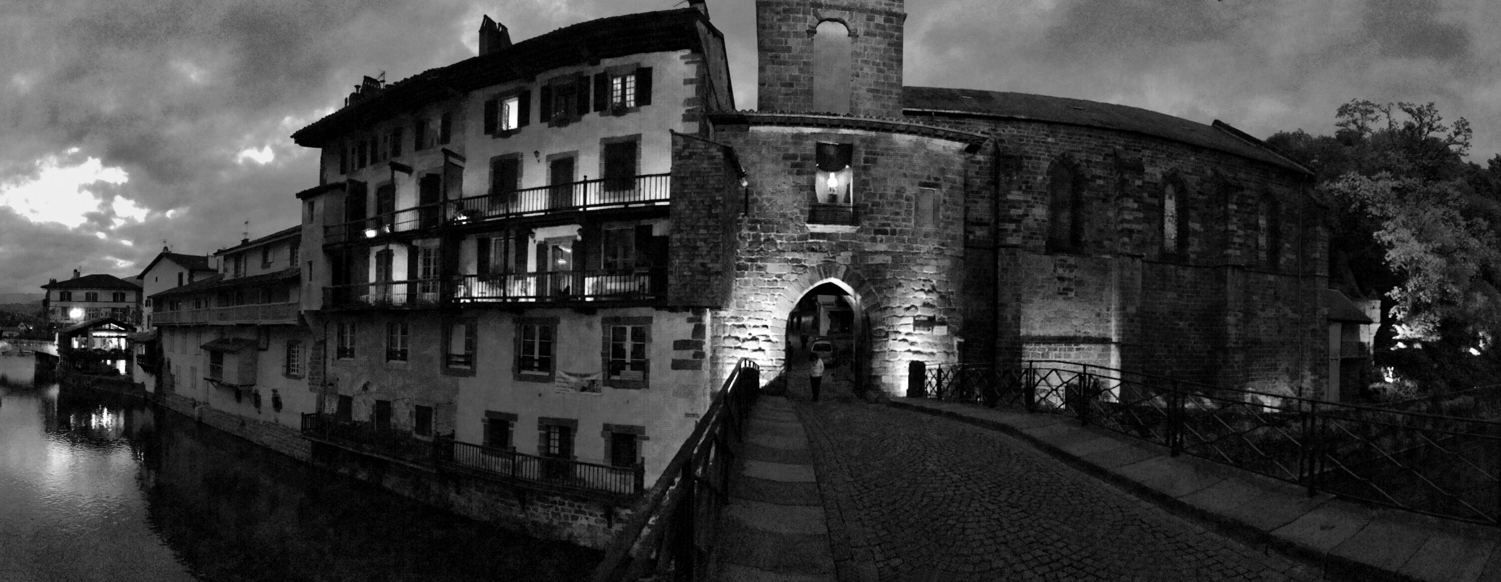
The town-side setting: bridge, buildings and Porte Notre-Dame, in Edmir Silvestre's original monochrome photograph published in November 2015. This view complements the later mountain landscape; it does not show the Cize commission's office, a market session or a border checkpoint. The capture date is unconfirmed: the retained September 2015 EXIF field is a modification timestamp, not a verified shooting date. Photo: Edmir Silvestre, original photograph, CC BY 2.0. Unchanged full frame; no identity or activity is attributed to the small passer-by.
A facería is a negotiated relationship
The Junta General del Valle de Aezkoa explains that much of its unfenced pasture is included in the arrangement with Cize, whose origin it dates to 1556. Its description of the annual agreement includes livestock quotas, charges by animal type and other conditions of grazing. This is an organised system of use, rather than a general invitation for any herd to roam across a border. Aezkoa governing body's pasture information.
The term facería, rendered facérie in French accounts, is best understood here through that local example. Different agreements elsewhere in the Pyrenees have their own histories and terms. A single colourful phrase about “ancient border freedom” would conceal those differences.
The practical issues are easy to recognise without pretending to administer the system. Grazing has to accommodate different animals, available ground and the people responsible for them. An arrangement that lasts must be capable of addressing particular needs. Repetition is part of its strength: neighbours return to an agreement rather than assuming yesterday's understanding will resolve every new circumstance.
Iropile gives the relationship a meeting place
The cross-border Irati project identifies Iropile as a meeting site for Cize and Aezkoa to renew the pasture agreement. Its account connects the 1556 arrangement with the later boundary framework of 1856. It describes a customary July gathering, which should not be used as a confirmed date for a future edition without checking the organisers. Irati project's Cize interpretation.
A named meeting place matters. Agreements can otherwise sound like documents produced far from the landscape. Gathering near the ground concerned makes the relationship visible to participants and gives the renewal a social setting.
The celebration does not need to be stripped away to find the “real” business underneath. Sharing a meal and renewing a working relationship can belong to the same occasion. At the same time, photographs of a gathering do not establish the precise terms of a signed agreement. The public ceremony and the operational document are different kinds of evidence.
Treat accounts of continuity with appropriate care. Long histories can include changes in participants, management and practical conditions. The fact that a custom has an old reference point does not mean every detail has remained unchanged since that year.
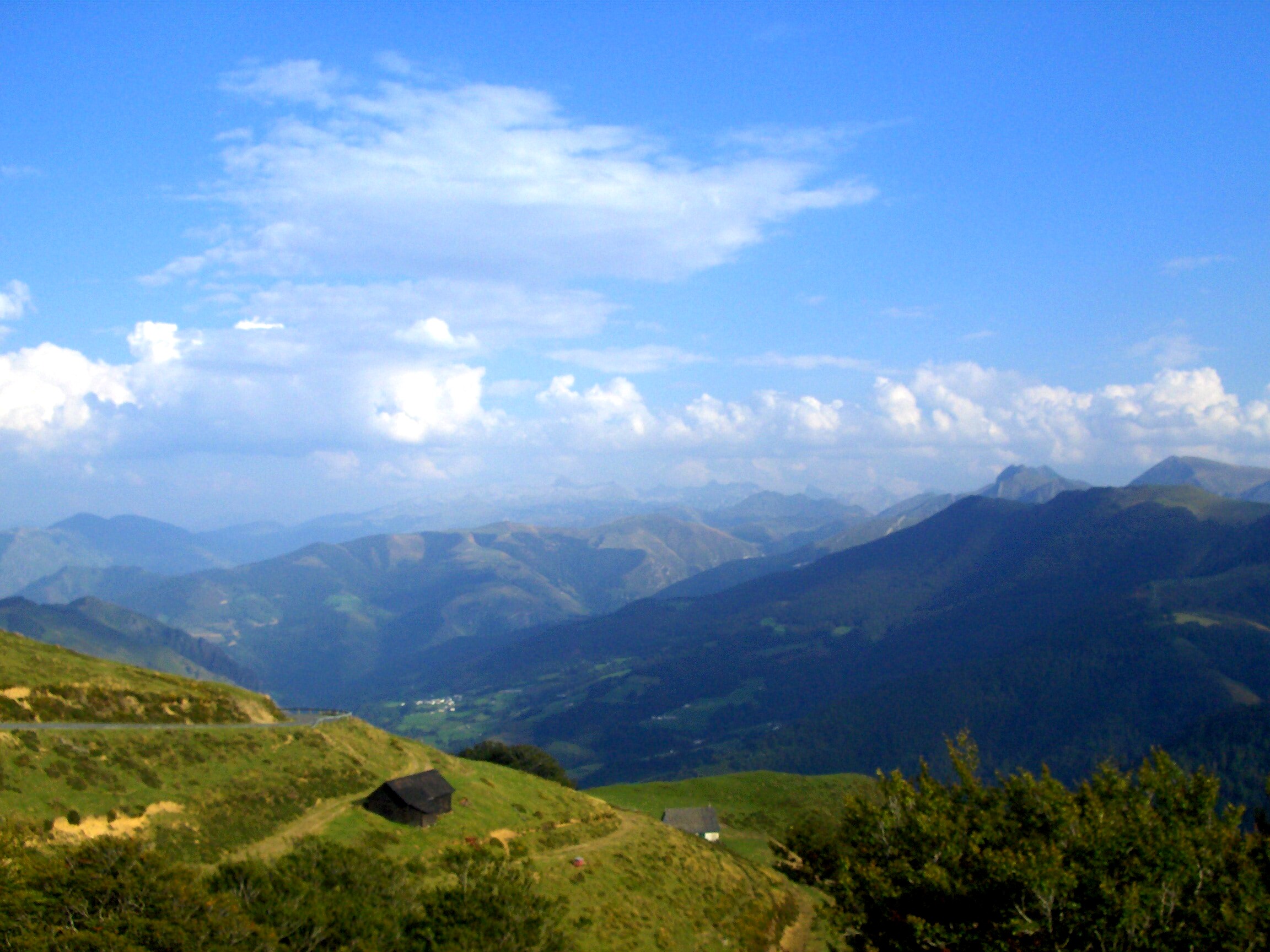
Iraty landscape, 16 September 2007. The road, buildings and wooded slopes make useful regional context for the infrastructure discussed here; the photograph does not identify an Iropile meeting, a particular grazing allotment or the owner and use of any cabin. Photo: ANDRE Céline, original photograph, CC BY 2.0. Unchanged full frame. The photographer identifies the wider Iraty area; the precise viewpoint and national side are not established here.
Seasonal movement depends on more than the pass
The federation of mountain commissions describes Cize's estive system through summer grazing, shepherds' cabins and the infrastructure needed to support them. Its historical account records work on tracks, water supplies, housing improvements and solar equipment. These examples make seasonal occupation a material undertaking. Commission syndicale du Pays de Cize profile.
A pass is only one part of that undertaking. Animals need usable ground; people need access and places to work; water must be available where it is required. From a distant viewpoint, a small building or trough may barely register. For someone working an estive, it can be central to the day's activity.
This perspective also keeps the idea of transhumance from becoming a single procession staged for spectators. The journey between lower land and summer pasture is embedded in a longer season of husbandry. Arrival in the mountains does not complete the work.
The commission's web profile contains older personnel and livestock figures, so it is used here for its institutional and historical description, not as a verified 2026 staffing list or stock count. Conditions and practical arrangements should be checked with the relevant managers.
Neighbouring valleys can share pasture without farming identically
Aezkoa's governing body describes a predominance of cattle among its own farms using communal grazing, while Cize farms accessing the facería are chiefly associated with sheep. Mixed holdings also feature in its account. The comparison concerns the users described on that page; it is not a complete census of agriculture on either side of the Pyrenees. Aezkoa pasture account.
This difference is useful because border regions are often pictured as perfectly symmetrical: the same landscape, the same village and the same work on either side. Shared ground can instead bring unlike needs together. Cooperation does not require every participant to run an identical farm.
When viewing livestock from a public path, avoid assigning nationality or ownership by appearance. The agreement itself is a reminder that an animal's location need not identify where its holding is based. A breed, a bell or a picturesque cabin is not enough to reconstruct the farm's legal and economic arrangements.
Ask a producer about their own work if an appropriate opportunity arises. A precise account of one holding is more valuable than a sweeping claim that all border residents live in the same way.
The town's market connects the valleys to everyday exchange
The departmental tourism organisation identifies Saint-Jean-Pied-de-Port's Monday market as a meeting point for producers from the surrounding Cize–Baïgorry area. This gives the town a recurring economic role alongside its better-known pilgrim traffic. Tourisme 64: Saint-Jean-Pied-de-Port.
The market is a place to ask where a product comes from and how it was made. It cannot, by itself, tell you whether a particular cheese is linked to a cross-border grazing arrangement. That connection needs the producer's evidence. A regional name on a stall should not be converted automatically into a story about the facería.
Think of the market as one point within a network rather than the end of a scenic route. Work carried out above the valley can reach a customer through processing, transport and sale. Some of those links may be visible in a conversation; others remain outside the visitor's view.
That is enough to deepen the town's meaning. The mountain backdrop supplies more than scenery. It is connected to households, working calendars and institutions whose activity continues when the main street is quiet.
An interpretation centre can make the work visible
The Ossau-Iraty producers' organisation lists Etxola on the Iraty-Cize plateau as an interpretation space about mountain life, shepherding and sheep's-milk cheese. Its description includes a reconstructed kaiolar and interpretation of pastoral work. The location is Chalet de Cize, Plateau d'Iraty–Cize, 64220 Lecumberry, outside Saint-Jean-Pied-de-Port. Etxola visitor record.
Locate Etxola in Google Maps. The link identifies a named destination, not a checked mountain-driving itinerary. The published page combines seasonal opening information with programme details of uncertain year; confirm the intended visit directly.
An interpretation space is particularly useful when it explains equipment and everyday tasks that cannot responsibly be explored by entering working cabins. A display can introduce a question; a scheduled encounter may allow a shepherd to answer it. Neither requires treating private working space as an unrestricted attraction.
For orientation within the town, the commission's verified directory address is Cité administrative, place Charles de Gaulle, 64220 Saint-Jean-Pied-de-Port. Locate that address. This is an administrative location, not a promise of a walk-in exhibition or visitor service.
The lasting insight is a practical one: neighbouring communities have to keep making the border workable. An annual signature, a grazing decision, a water installation and a market conversation belong to different scales of that effort. Together they make Saint-Jean-Pied-de-Port's surrounding passes part of a lived region rather than merely a line to cross.
Source register and limits
Primary institutional sources checked 27 October 2026: Aezkoa valley's celebration account; Junta General del Valle de Aezkoa's pasture description; the joint Irati interpretation project; the federation's Cize commission profile; Communauté Pays Basque's manager directory; Tourisme 64's town page; the Ossau-Iraty organisation's Etxola record. No original 1556 settlement, 1856 treaty sheet or signed 2026 grazing agreement was inspected. Historical dates are attributed to the institutions' published accounts. No present quota, payment entitlement or livestock-movement permission is certified.
The generic tradition page's “more than 500 years” wording was not used to calculate a date. Sources disagree in contextual counts of villages and symbolic markers; the article uses the institutional directory's twenty-commune management description without equating it to every historical grouping. Historical customs are separated from current visitor, border and agricultural regulations.